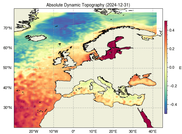
The gridded Sea Level Anomalies (SLA) presented result from the application of the Multiscale Inversion of Ocean Surface Topography (MIOST) algorithm, as described by [Ubelmann et al., 2019]. The algorithm takes as input Level-3 altimeter data distributed by the Copernicus Marine Service. This product provides additional variables such as Absolute Dynamic Topography and geostrophic currents (both absolute values and anomalies) at a resolution of 1/16° over the Europeans Seas and for the period from 2023-03-28 to 2024-12-31. It is intended for delayed-time applications.
The dataset is available on Zenodo:
Ballarotta, M. (2025). ESA COASTDyn – European Seas Gridded MIOST L4 Sea Surface Heights And Derived Variables [Data set]. Zenodo. https://doi.org/10.5281/zenodo.16793036