One year after project kick-off, COASTDyn has successfully completed the development and release of its first generation of coastal Earth observation products, demonstrating the project’s progress toward improving the monitoring of complex coastal and shelf-sea environments. The first-year activities have focused on the development, testing and validation of five innovative datasets covering sea level, ocean circulation, tides and high-resolution altimetry.
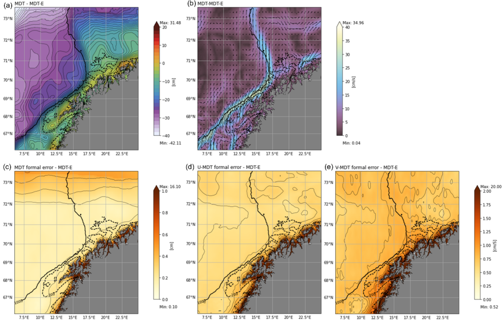
A first key achievement is the development of a high-resolution Coastal Mean Dynamic Topography (MDT) product for the Lofoten-Vesterålen region. The work combines geoid, satellite altimetry, hydrographic observations, drifters and SAR-derived currents, while also exploring machine-learning techniques to better exploit coastal observations that are traditionally underused
Product reference: [Jousset, S. (2026). ESA COASTDyn – Coastal Mean Dynamic Topography in Lofoten-Vesterålen region [Dataset]. Zenodo. https://doi.org/10.5281/zenodo.22274425 ]
COASTDyn has also produced a new multimission sea-level mapping product based on the MIOST framework, integrating both conventional altimetry and SWOT KaRIn observations. The resulting dataset provides daily maps of sea level and geostrophic currents across the European Atlantic façade and adjacent seas, demonstrating the added value of wide-swath altimetry for coastal monitoring.
Product reference: [BALLAROTTA, M. (2025). ESA COASTDyn – European Seas Gridded MIOST L4 Sea Surface Heights And Derived Variables [Dataset]. Zenodo. https://doi.org/10.5281/zenodo.16793036]
A third development explores the potential of combining SWOT and Fully Focused SAR (FFSAR) altimetry to improve the observation of coastal tides in the Wadden Sea. A dedicated high-resolution FFSAR altimetry dataset from Sentinel-6 observations was generated over selected coastal regions to support this activity. These data provide unprecedented along-track detail and support both current project developments and future scientific applications. Initial results confirm the feasibility of jointly exploiting these complementary datasets and provide valuable insights for future coastal tide products.
Finally, the project has further advanced the use of Sentinel-1 SAR observations for surface current estimation. New experimental approaches have been tested to better separate ocean-current signatures from wave-related signals, paving the way for improved retrieval of coastal surface circulation from radar observations.
Product reference: [Moiseev, A. (2026). ESA COASTDyn – High-Resolution Total Surface Current Radial Velocity derived from Sentinel-1 DCA over Lofoten-Vesterålen (Version 1.0) [Dataset]. Zenodo. https://doi.org/10.5281/zenodo.22206123]
With these first-year milestones achieved, the project now moves into the analysis of coastal processes inside three different regions the Lofoten-Vesteralen region, the Wadden Sea, and the Biobio/Arauco Gulf in Chile.